|
Oct
12
2026
|
|
Posted 1 hour ago ago by Admin
|
|
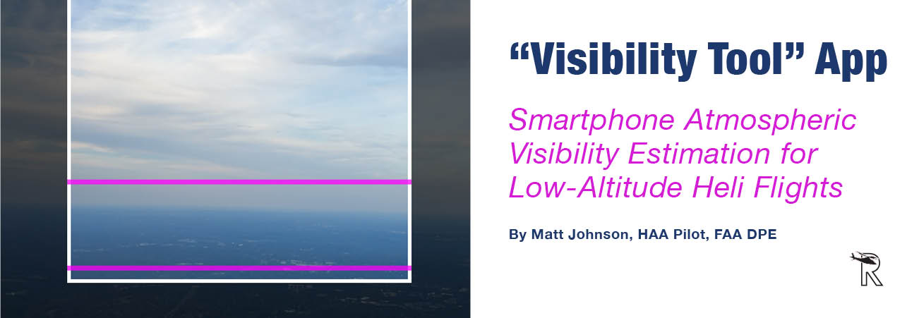
Those that know me will tell you I am a card-carrying member of the weather-geek community. While I’m not one to study in-depth meteorology and never have been, I truly love weather products that help me safely and effectively do my job. A lot of people much smarter than me take care of weather forecasting; I simply like to know where to go and how to read that information and pass that knowledge on to others.
It is no shock that helicopter operations frequently occur in low-altitude, complex-terrain, and off-airport environments where certified meteorological visibility observations are sparse or unavailable. Conventional weather reporting systems, including automated weather observing systems (AWOS) and automated surface observing systems (ASOS), provide localized point measurements that may not accurately represent visibility conditions along helicopter flight routes, approach corridors, or in my case as an HAA Pilot, remote landing zones. I am always on the hunt for the next break-through that will provide insight, literally and figuratively when it comes to our low-level operating environment.
One new weather “gizmo” recently caught my attention. A new application of a smartphone-based visibility estimation tool designed to support helicopter-specific decision-making. The app uses image contrast analysis from a standard smartphone camera, and then the system estimates atmospheric visibility in real time and reports values in one-mile increments. The system provides an “on the go” visibility assessment intended to supplement pilot situational awareness in areas lacking certified weather infrastructure. Like so many other products, it is an interesting tool and I am optimistic about its use!
It’s Practical
It’s not just HAA, but other operations such as, utility operations, aerial firefighting, law enforcement aviation, and offshore transport that often require pilots to conduct operations away from airports and outside the coverage area of certified weather observing systems.
Operational decision-making for these flight profiles typically relies on a combination of meteorological aviation reports (METARs), Automatic Terminal Information Service (ATIS), AWOS/ASOS observations, pilot reports, and visual assessment. Airport-based observations frequently fail to capture weather conditions within valleys, ridgelines, approach paths, and remote landing zones relevant to low-altitude helicopter operations.
This is where I believe this product will excel, as it can estimate atmospheric visibility directly from your operational environment. The system uses real-time image analysis to evaluate terrain-feature contrast degradation over distance and generate an objective visibility estimate intended to supplement pilot weather assessment.
Concept
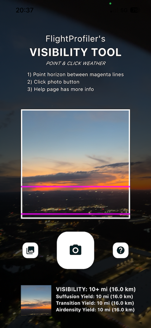
In short, the Visibility Tool application operates using a smartphone camera and onboard image-processing algorithms within the app. The system analyzes contrast attenuation between terrain features and the surrounding atmosphere to estimate the maximum distance at which objects remain visually discernible.
Unlike AWOS or ASOS systems, which measure atmospheric scattering within a localized sensor volume, this smartphone-based approach evaluates visibility over the actual field of view relevant to the user. This distinction is particularly important for helicopter operations where visibility may vary significantly along the intended flight path due to terrain-induced meteorological effects.
The application reports visibility values in one-mile increments to align with commonly used operational thresholds for low-altitude rotorcraft operations. Visibility estimates are generated in real time without requiring network or cellular connectivity after installation.
The system is designed to provide conservative estimates when image contrast degrades rapidly due to haze, fog, smoke, or terrain obscuration. Under favorable atmospheric conditions, the application reports extended visibility when distant terrain features remain clearly resolved.
Operational Relevance
Helicopter operations frequently involve landing zones that are not known in advance and may include highways, fields, parking lots, remote utility corridors, or confined terrain environments. As a result, pilots must often assess visibility in areas lacking nearby certified weather reporting infrastructure. Let's face it; we have to already “be there” to “see” what’s going on. Just what if a first-responder, LZ Commander, etc. was able to utilize this app and relay that information to us in a timely fashion?
The Visibility Tool is intended as a supplemental situational-awareness aid for:
• Off-airport landing zone assessment
• En route visibility evaluation
• Remote area weather reconnaissance
• Pre-arrival landing zone coordination
• Operational risk assessment in marginal visual meteorological conditions
Limitations
As one could imagine, the system depends on adequate image quality and environmental contrast conditions. Measurement performance may be degraded under various conditions such as:
• Low-light or night operations
• Lens contamination or image blur
• Uniform visual scenes lacking identifiable terrain features
• Severe precipitation or atmospheric obscuration
When measurement confidence is insufficient, the application generates an error message instructing the user to repeat the measurement or reassess environmental conditions. In a perfect world, I would love to see a product capable of night-time use. Perhaps that will happen as technology evolves.
Obviously, the application is not intended to replace certified meteorological observations or pilot judgment. Rather, it serves as a supplemental operational aid designed to improve situational awareness and safety in areas where conventional visibility observations are unavailable or operationally unrepresentative. "Safety begins with knowing what you can actually see—not what the nearest weather station reported 15 minutes ago. Visibility Tool provides pilots with instantaneous, location-specific visibility measurements that enable safer go/no-go decisions and reduces the risk of inadvertent flight into instrument meteorological conditions,” said Ethan Krimins, president of FlightProfiler, the company who developed the tool.
Background Origin
Being an inquisitive weather product geek, I dug deeper into this app and its origins. Visibility Tool was developed by FlightProfiler as part of the Low Altitude Weather Network (LAWN), a multi-year research initiative focused on low-cost atmospheric sensing technologies for manned and unmanned aviation applications. The effort included collaboration with Ohio University, Ohio State University, the U.S. Air Force, and NASA. That’s an impressive collaboration group!
Conclusion
Smartphone-based atmospheric visibility estimation represents a potentially useful supplemental capability for helicopter operations conducted in complex-terrain and infrastructure-limited environments. By evaluating visibility directly within the operational field of view, the system provides an assessment that differs fundamentally from traditional point-based weather observations.
Future work may include expanded validation against certified meteorological observations, integration with operational flight systems, and assessment across a wider range of environmental and atmospheric conditions. Either way, I just had to be one of the cool kids to get the app. Geek out!
READ MORE JUL/AUG ISSUE
READ MORE ROTOR PRO: https://justhelicopters.com/Magazine
WATCH ROTOR PRO YOUTUBE CHANNEL: https://buff.ly/3Md0T3y
You can also find us on
Instagram - https://www.instagram.com/rotorpro1
Facebook - https://www.facebook.com/rotorpro1
Twitter - https://twitter.com/justhelicopters
LinkedIn - https://www.linkedin.com/company/rotorpro1