|
Nov
28
2022
|
|
Posted 3 years 78 days ago ago by Admin
|
|
VIEW VIDEO
As a resident of this state for 42 years, I find it interesting that Florida is the second-most popular tourist state in the country despite the fact that we’re home to hurricanes, sharks, alligators, rattlesnakes, scorpions, bats, fire ants—and mosquitoes.
And we’re not talking about just any little mosquito. Florida mosquitoes are so huge they have N-numbers and get issued squawk codes by air traffic control! However, most of those who live here just shrug it off and say that it’s the price we pay to live in paradise – that is, until you cannot even walk your dog or sit on your deck without being carried away by the blood-sucking pests.
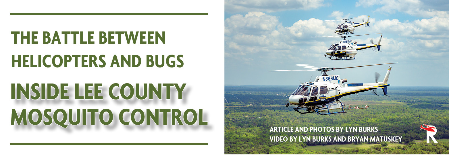
Fear not: many organizations across the state are using both science and aircraft to reduce the impact of mosquito misery on the people. Once such organization is the Lee County Mosquito Control District (LCMCD), which is the largest mosquito control agency in the country.
428 Square Miles of Water
Lee County is a southwest Florida community established in 1887, with a population of about 750,000 people. Featuring a rich Indian history dating back beyond a millennium, it was previously dominated by the Caloosahatchee, Calusa and then Seminole people. Today, with the City of Fort Myers as its county seat, the beaches are especially popular with local families, retirees, and tourists.
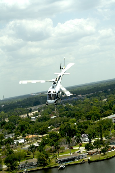
Lee County has a total area of 1,212 square miles, of which 785 square miles is land and 428 square miles (35.3%) is water. Rivers and streams include the Caloosahatchee River, Imperial River, Estero River, Hendry Creek, and Orange River. All this liquid leads to an overload of mosquitoes.
Why Bother?
Mosquitoes have existed since Jurassic times, and they now number a staggering population of 110 trillion . This buzzing bugs are surprisingly our biggest foe, killing off an estimated half of humankind over the milleniums, according to the book The Mosquito: the Human History of Our Deadliest Predator by Timothy C. Winegard.
But the United States is lucky to be relatively free of mosquito-borne diseases compared to others. So some people might ask, why bother to go to huge lengths to control mosquitoes? After all, aren’t they natural to the environment?
The answer to the second question is an easy yes. The first question, however, has many layers. And as with most environmental issues, it begins when the comfortable world of humans interfaces with the harsh world of nature – especially where plenty of standing water joins the mix. In this case, people want a comfortable environment, and the only thing the mosquitoes want is the blood sacrifice of your children and animals. And therein lies the rub.
Although there are several impacts mosquitoes might have on communities, the two most common that drive the policy of mosquito control districts are economic and health safety.
On the economic side, if the mosquitoes were so thick that they could carry a grown man away, it’s likely that a drastically reduced number of people would want to live in or visit such a place. It can stifle the economy.
On 13 Sept. 2022 health officials in a neighboring county issued a Mosquito Borne Illness-Advisory that stated:
The Florida Department of Health in Hillsborough County (DOH-Hillsborough) advises residents and visitors that there has been an increase in mosquito-borne disease activity in northwestern Hillsborough County. Eastern Equine Encephalitis has been detected in twoS horses, heightening the risk of transmission to humans. DOH-Hillsborough reminds residents and visitors to avoid being bitten by mosquitoes and to take basic precautions to help limit exposure.
This is a common type of advisory in Florida, and highlights how the health and safety of residents and livestock come into play. Mosquito-borne diseases found in “The Sunshine State” include West Nile virus disease, Eastern equine encephalitis, Equine Infectious Anemia, and St. Louis encephalitis. Many other mosquito-borne diseases are found in different parts of the world, and can be brought back to Florida if infected people or animals are bitten by mosquitoes while in Florida. Some examples of these diseases include chikungunya fever, dengue fever, malaria, yellow fever, and Rift Valley fever.
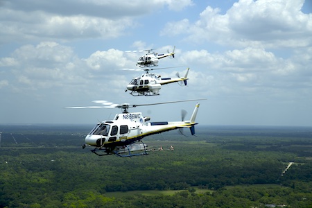
To protect the residents and visitors from the health hazards of mosquitoes, the LCMCD deploys an army of dedicated personnel, six Airbus H125 helicopters, two turboprop DC-3 airplanes, three King Air airplanes, as well as UAS (unmanned aerial systems).
Surveillance
The LCMCD has divided Lee County into six geographic areas, with each assigned a helicopter, pilot and aerial inspector. Inside each of these areas are known sites with low-lying land that holds water following heavy rains or high tides. There are hundreds of these egg-laden locations and they are the key to staying ahead of the mosquito population.
Following a heavy rain, a full day of surveillance may require an aerial inspection team to land at 20 to 30 different dip sites, which are small landing zones carved out of the mangroves. For all the high-tech equipment and scientific methods used in the job of mosquito control, the surveillance portion is a very low-tech manual process.
“These aerial inspectors know their areas inside out, every little puddle that might be breeding; even a small hole can create hundreds of thousands of mosquitoes,” said Thurbie Botterill, chief pilot for LCMCD.
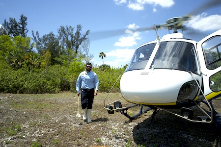
The process looks like this: land the helicopter, hike into the woods, use a handheld dip net to scoop water from low areas, then count the mosquito larvae in the dip net. Although this task is simple, the data obtained by that low-tech dip net is the genesis for every downstream decision related to mission planning. Whether to be preventative or reactive. What products to use. Where to spray. What type of product delivery system to use. What aircraft to use, and so on.
Mission Planning
Immediately following the manual surveillance of an area, the process instantly departs from the low-tech ether into the realm of a high-tech, data-driven environment. Once the surveillance data is obtained, it’s immediately uploaded to a server to guide a digital mission planning process.
Once the surveillance of an area is complete and the data is uploaded, the team typically has only a few days to develop and execute a mission plan for that geographic location, otherwise an application may become ineffective. Using the surveillance data, digital mapping software, weather forecasts, tidal charts, science, and a little gut instinct, the team will build mission plans to treat the area.
Mission plans will determine:
• What product will be used (larvicide / adulticide)
• What aircraft will be used (helicopter, airplane, UAS)
• What distribution method will be used (granular, spray, ultra low volume - ULV)
• When the flights will occur, day or night
• The exact area to be treated and flight paths to be flown (aka the “polygons”)
Once the mission plans are created, pilots can download their polygons for the day’s flights directly to the helicopter’s mapping system. Multiple polygons can be flown in one flight. The pilot will typically begin with the site farthest away and work their way back to the airport.
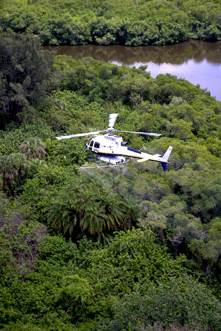
Larviciding (killing mosquitoes in the larvae stage) will traditionally occur during daylight hours using either the helicopters or the UAS, depending on the location and the volume required. For areas of open swamp or marshland, helicopters outfitted with spray tanks will distribute the larvicide in liquid form. For areas where there is canopy coverage from trees, helicopters outfitted with granular dispensers are used since the heavier granules are more able to penetrate the canopy and reach the ground.
Understanding that the larvicide missions will not completely eradicate all the mosquitoes, the second wave of the assault will typically occur when the adult mosquitoes that survived the larviciding are most active: at night. This is when the fixed-wing aircraft join the fight as they head out under the cover of darkness to apply adulticide in liquid form. Using night vision goggles, the airplane pilots normally fly their polygons at an altitude of 300 feet above the ground and at a speed between 120 and 150 knots. Flying at such low altitudes in the dark requires an exceptionally high level of situational awareness.
Technology Helps
Without a doubt, mapping technology has been this job’s biggest enhancement over the last decade. The moving map provides precise visual cues to the pilot to guide the aircraft on specific lines. Botterill reflects, “Back when I first started 15 years ago, we relied on verbal descriptions of the area and might have used palm trees as a guide, only to realize you used the same palm tree too many times and sprayed the same picnic bench more than once.” With the moving-map guidance systems, pilots today fly much more accurate passes. In turn, this decreases both errors and overlaps while reducing the amount of product that is wasted, thereby saving the operation and citizens money.
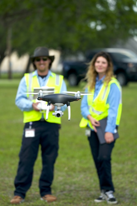
The most recent technological investments feature the UAS, a trend across many mosquito control districts. LCMCD not only uses the UAS for ultra-low volume larviciding, but for LIDAR (light detection and ranging) mapping as well. LIDAR enables the agency to scan areas that are unobservable with the naked eye from aircraft above. It enables them to clearly see hidden, low-lying troughs beneath the tree canopy where water might stand and become massive breeding grounds for mosquitoes.
The other place where UAS has been a game changer is in small areas where residents live in close proximity to the application sites. “With all the new development occurring, condos are being built right up against mosquito breeding grounds. It can seem extreme flying these missions right up against these buildings with the helicopters, but the unmanned aircraft can easily treat those very tight areas and it’s not so intimidating for residents,” says Botterill.
Collaboration is Key
During my visit, the LCMCD was hosting a two-day educational workshop for hundreds of mosquito control district personnel from other programs as well as their own. It included a fly-in with numerous helicopters from other districts, product demonstrations, and presentations on more than a dozen educational topics.
The purpose of this annual event is two-fold. First, it creates a place for agencies to share what they are doing and learn from others. The second purpose is to provide attendees with the opportunity to obtain continuing education credits towards certificate or license renewal.
“Just because Lee County is the biggest mosquito control district in the country doesn’t always mean you’re the furthest ahead. You learn a lot by looking at what other agencies are doing,” Botterill indicated. That humble position alone will likely assure the success of the organization.
With that attitude, there’s no doubt that LCMCD will remain a leader in the mosquito control industry and contribute to its advancement.
VIEW VIDEO
READ MORE ROTOR PRO SEP/OCT ISSUE
READ MORE ROTOR PRO: https://justhelicopters.com/Magazine
WATCH ROTOR PRO YOUTUBE CHANNEL: https://buff.ly/3Md0T3y
You can also find us on
Instagram - https://www.instagram.com/rotorpro1
Facebook - https://www.facebook.com/rotorpro1
Twitter - https://twitter.com/justhelicopters
LinkedIn - https://www.linkedin.com/company/rotorpro1